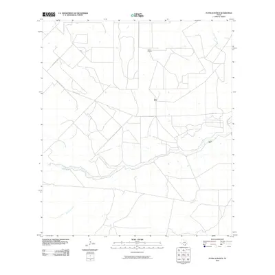
2010 Map of Flying W Ranch
USGS Topo · Published 2010About this map
The Nueces River winds through this South Texas landscape in La Salle County, anchoring a terrain defined by ranching life and riparian hydrology. Large landholdings like the Flying W Ranch and Riche Ranch mark the region's agricultural character, served by a network of rural routes including Valley Wells Rd and La Quebrada Ranch Rd. Several seasonal waterways, such as Sauz Mocho Creek, San Roque Creek, and Espio Creek, drain toward the river basin. The presence of Ritchie Dam on the river indicates the essential role of water management in this arid environment, supporting local ranching operations and livestock during the early twenty-first century.
Find a feature on this map
11 named features on this map. Tap any name to fly to it.
Don’t see what you’re looking for? This feature index may not catch every label — zoom into the map to look around manually.
Map Details
Editions of this 2010 Flying W Ranch Map
This is the sole edition of this map. No revisions or reprints were ever made.
Other maps of this area

1925 · San Roque Lake 1-a
USGS Topo · 1:48,000

1927 · Bart
USGS Topo · 1:62,500

1929 · Cotulla
USGS Topo · 1:125,000

1932 · Valley Wells
USGS Topo · 1:62,500

1939 · Big Wells
USGS Topo · 1:62,500

1940 · Catarina
USGS Topo · 1:62,500

1940 · Artesia Wells
USGS Topo · 1:62,500

1953 · Crystal City
USGS Topo · 1:250,000

1955 · Crystal City
USGS Topo · 1:250,000

1956 · Woodward
USGS Topo · 1:62,500