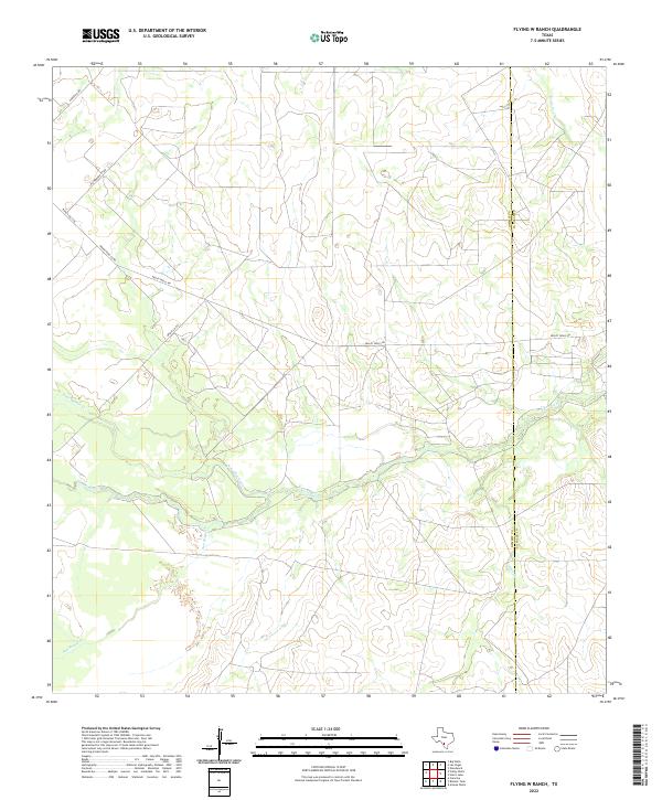
2022 Map of Flying W Ranch
USGS Topo · Published 2022About this map
The Nueces River winds through the heart of this South Texas landscape, defining a riparian corridor through the brush country of the Dimmit and La Salle county line. This 2022 survey documents a sparsely populated ranching region where drainage systems like Sauz Macho Cr and San Roque Cr dictate the layout of the local transport network. The map reveals how modern infrastructure, including Ranch Rd 1558 and Valley Wells Rd, serves the expansive properties in this area. Named county routes such as Archie Co Rd and Henrichson Co Rd provide critical access points for researchers and land managers tracking the evolution of these historic South Texas holdings.
Find a feature on this map
12 named features on this map. Tap any name to fly to it.
Don’t see what you’re looking for? This feature index may not catch every label — zoom into the map to look around manually.
Map Details
Editions of this 2022 Flying W Ranch Map
This is the sole edition of this map. No revisions or reprints were ever made.
Other maps of this area

1925 · San Roque Lake 1-a
USGS Topo · 1:48,000

1927 · Bart
USGS Topo · 1:62,500

1929 · Cotulla
USGS Topo · 1:125,000

1932 · Valley Wells
USGS Topo · 1:62,500

1939 · Big Wells
USGS Topo · 1:62,500

1940 · Catarina
USGS Topo · 1:62,500

1940 · Artesia Wells
USGS Topo · 1:62,500

1953 · Crystal City
USGS Topo · 1:250,000

1955 · Crystal City
USGS Topo · 1:250,000

1956 · Woodward
USGS Topo · 1:62,500