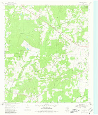
1963 Map of Fodice
USGS Topo · Published 1981About this map
Davy Crockett National Forest dominates the northern landscape of this East Texas survey, providing a backdrop for the agricultural and timber-based communities of Houston and Trinity counties. The small settlement of Fodice serves as a local focal point, anchored by the Fodice Cem and nearby Mt Pleasant Ch. This era of rural development is marked by a high density of country churches and family-named landmarks, such as Shady Grove and its associated Shady Grove Ch and Shady Grove Lookout Tower.
Find a feature on this map
26 named features on this map. Tap any name to fly to it.
Don’t see what you’re looking for? This feature index may not catch every label — zoom into the map to look around manually.
Map Details
Editions of this 1963 Fodice Map
2 editions found
Other maps of this area

1950 · Crockett
USGS Topo · 1:24,000

1951 · Crockett
USGS Topo · 1:24,000

1951 · Kennard
USGS Topo · 1:24,000

1951 · Berea
USGS Topo · 1:24,000

1953 · Palestine
USGS Topo · 1:250,000

1957 · Palestine
USGS Topo · 1:250,000

1962 · Lovelady South
USGS Topo · 1:24,000

1962 · Glendale
USGS Topo · 1:24,000

1963 · Lovelady North
USGS Topo · 1:24,000

1963 · Groveton West
USGS Topo · 1:24,000