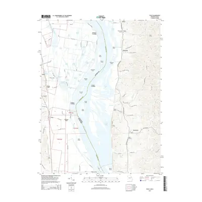
2015 Map of Foley
USGS Topo · Published 2015About this map
Mississippi River floodplains and the bluffs of Lincoln County dominate this landscape, where the state line bisects a complex network of backwaters and islands. The river is a labyrinth of side channels like Crooked Slough and George Bain Slough, creating numerous landforms such as Turner Island and Hausgen Island. These features illustrate the shifting hydrology of the valley before modern stabilization efforts could fully isolate the river from its original basin.
Find a feature on this map
114 named features on this map. Tap any name to fly to it.
Don’t see what you’re looking for? This feature index may not catch every label — zoom into the map to look around manually.
Map Details
Editions of this 2015 Foley Map
This is the sole edition of this map. No revisions or reprints were ever made.
Other maps of this area

1903 · O'Fallon
USGS Topo · 1:125,000

1930 · Hardin
USGS Topo · 1:62,500

1931 · Brussels
USGS Topo · 1:62,500

1934 · Elsberry
USGS Topo · 1:48,000

1934 · Hardin
USGS Topo · 1:62,500

1938 · Hardin
USGS Topo · 1:62,500

1939 · Brussels
USGS Topo · 1:62,500

1941 · Troy
USGS Topo · 1:62,500

1942 · Elsberry
USGS Topo · 1:62,500

1943 · Brussels
USGS Topo · 1:62,500