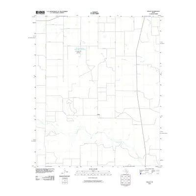
2010 Map of Folley
USGS Topo · Published 2010About this map
Folley serves as a central point in this rural Motley County landscape, where the flat plains of the Texas Panhandle are carved by an intricate network of waterways. The southern portion of the quadrangle is defined by the wandering path of Quitaque Creek, which is joined by several smaller tributaries as it moves across the territory. To the north, Kent Creek and Turkey Creek drain the open country, illustrating the vital role of water management in this agricultural region. Evidence of mid-century infrastructure is found at the Soil Conservation Service Site 7 Reservoir, held by the Soil Conservation Service Site 7 Dam. This network of ranch roads, such as Ranch Rd 2733 and Ranch Rd 599, connects isolated farmsteads and grazing lands, reflecting a late 20th-century landscape dedicated to livestock and large-scale land conservation efforts.
Find a feature on this map
32 named features on this map. Tap any name to fly to it.
Don’t see what you’re looking for? This feature index may not catch every label — zoom into the map to look around manually.
Map Details
Editions of this 2010 Folley Map
This is the sole edition of this map. No revisions or reprints were ever made.
Other maps of this area

1954 · Plainview
USGS Topo · 1:250,000

1958 · Plainview
USGS Topo · 1:250,000

1967 · Quitaque
USGS Topo · 1:24,000

1967 · North Windmill
USGS Topo · 1:24,000

1967 · Tampico Siding
USGS Topo · 1:24,000

1967 · Quitaque Peaks
USGS Topo · 1:24,000

1967 · Hornica Creek
USGS Topo · 1:24,000

1967 · Flomot
USGS Topo · 1:24,000

1967 · Turkey
USGS Topo · 1:24,000

1967 · Lake Theo
USGS Topo · 1:24,000