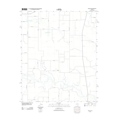
2012 Map of Folley
USGS Topo · Published 2012About this map
The small settlement of Folley serves as the central landmark for this West Texas landscape in the early 21st century. The terrain is defined by a dense network of county roads and ranch-to-market routes that segment the plains into a geometric grid. Significant hydrological features include Quitaque Cr winding through the southern portion of the quadrangle and Kent Cr further north. The map also records mid-century infrastructure in the form of two large catchment basins: Soil Conservation Service Site 5 Reservoir and Soil Conservation Service Site 7 Reservoir. This survey highlights the region's reliance on organized water management and an extensive rural road system, including Ranch Road 599 and Ranch Road 2733, which connect isolated ranching tracts to the modest center at Folley.
Find a feature on this map
35 named features on this map. Tap any name to fly to it.
Don’t see what you’re looking for? This feature index may not catch every label — zoom into the map to look around manually.
Map Details
Editions of this 2012 Folley Map
This is the sole edition of this map. No revisions or reprints were ever made.
Other maps of this area

1954 · Plainview
USGS Topo · 1:250,000

1958 · Plainview
USGS Topo · 1:250,000

1967 · Quitaque
USGS Topo · 1:24,000

1967 · North Windmill
USGS Topo · 1:24,000

1967 · Tampico Siding
USGS Topo · 1:24,000

1967 · Quitaque Peaks
USGS Topo · 1:24,000

1967 · Hornica Creek
USGS Topo · 1:24,000

1967 · Flomot
USGS Topo · 1:24,000

1967 · Turkey
USGS Topo · 1:24,000

1967 · Lake Theo
USGS Topo · 1:24,000