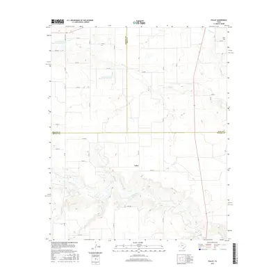
2016 Map of Folley
USGS Topo · Published 2016About this map
Folley serves as a central point in this landscape where the borders of Briscoe, Motley, and Hall counties converge. The terrain is defined by the sharp descent into the breaklands of Quitaque Creek, which carves a wide, complex drainage through the southern portion of the quadrangle. This canyon system stands in stark contrast to the level expanses of Wolf Flat to the northeast, illustrating the transition from the high plains to the rolling caprock breaks.
Find a feature on this map
37 named features on this map. Tap any name to fly to it.
Don’t see what you’re looking for? This feature index may not catch every label — zoom into the map to look around manually.
Map Details
Editions of this 2016 Folley Map
This is the sole edition of this map. No revisions or reprints were ever made.
Other maps of this area

1954 · Plainview
USGS Topo · 1:250,000

1958 · Plainview
USGS Topo · 1:250,000

1967 · Quitaque
USGS Topo · 1:24,000

1967 · North Windmill
USGS Topo · 1:24,000

1967 · Tampico Siding
USGS Topo · 1:24,000

1967 · Quitaque Peaks
USGS Topo · 1:24,000

1967 · Hornica Creek
USGS Topo · 1:24,000

1967 · Flomot
USGS Topo · 1:24,000

1967 · Turkey
USGS Topo · 1:24,000

1967 · Lake Theo
USGS Topo · 1:24,000