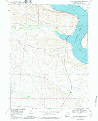
1968 Map of Fontenelle Reservoir SW
USGS Topo · Published 1979About this map
Holden Hill dominates the northern landscape of this Lincoln County region, where the high desert terrain meets the waters of the Fontenelle Reservoir. This 1968 field survey, published by the Geological Survey and featuring underwater contours from the U.S. Bureau of Reclamation, highlights a pivotal corridor for Western migration and modern energy infrastructure. The historic Emigrant Trail traverses the northwest, passing near the isolated Holden Cem, a significant marker for genealogical research in this sparsely settled area. The map illustrates the 1960s-era development of the Green River valley, including the Fontenelle Recreation Area and a complex network of pipelines that cut across the draws and hollows. Drainage systems like Fontenelle Creek and Pomeroy Draw define the topography, illustrating the harsh but managed environment of Wyoming’s high plateau during the mid-20th century.
Find a feature on this map
16 named features on this map. Tap any name to fly to it.
Don’t see what you’re looking for? This feature index may not catch every label — zoom into the map to look around manually.
Map Details
Editions of this 1968 Fontenelle Reservoir SW Map
2 editions found

Other maps of this area

1945 · Fort Hill
USGS Topo · 1:62,500

1947 · Fort Hill
USGS Topo · 1:62,500

1954 · Ogden
USGS Topo · 1:250,000

1955 · Preston
USGS Topo · 1:250,000

1958 · Ogden
USGS Topo · 1:250,000

1958 · Preston
USGS Topo · 1:250,000

1960 · Ogden
USGS Topo · 1:250,000

1962 · Preston
USGS Topo · 1:250,000

1968 · Anderson Canyon
USGS Topo · 1:24,000

1968 · Fontenelle Reservoir SE
USGS Topo · 1:24,000