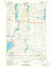
1966 Map of Forada
USGS Topo · Published 1991About this map
Maple Lake and the settlement of Forada anchor this mid-1960s landscape, illustrating the transition from Douglas County's agricultural roots to its managed conservation areas. The Soo Line railroad bisects the terrain, connecting the southern edge of Alexandria with the surrounding townships of Hudson and Leven. This era is defined by a heavy focus on public land management, evidenced by the National Wildlife Management Area and the Forada State Wildlife Management Area which preserve the intricate wetlands and smaller basins like Lovers Lake and Union Lake. Local community life is marked by rural education sites including the Technical Sch, Hazel Hill Sch, and Sunnyside Sch. The map also captures infrastructure of the period, from the Radio Towers (KXRA) to a rural Landing Strip, providing a clear view of the region's mid-century development and transport network.
Find a feature on this map
37 named features on this map. Tap any name to fly to it.
Don’t see what you’re looking for? This feature index may not catch every label — zoom into the map to look around manually.
Map Details
Editions of this 1966 Forada Map
3 editions found
Other maps of this area

1953 · Saint Cloud
USGS Topo · 1:250,000

1957 · Saint Cloud
USGS Topo · 1:250,000

1958 · Saint Cloud
USGS Topo · 1:250,000

1965 · Westport
USGS Topo · 1:24,000

1966 · Alexandria West
USGS Topo · 1:24,000

1966 · Osakis
USGS Topo · 1:24,000

1966 · Lake Osakis West
USGS Topo · 1:24,000

1966 · Lake Mary
USGS Topo · 1:24,000

1966 · Alexandria East
USGS Topo · 1:24,000

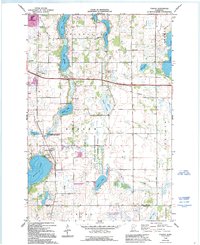
1966 · Forada
USGS Topo · 1:24,000