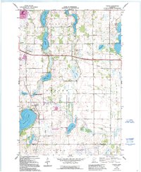
1966 Map of Forada
USGS Topo · Published 1995About this map
Glacial lakes and rural schoolhouses characterize this mid-1960s landscape south of Alexandria. The village of Forada sits on the western shore of Maple Lake, serving as a focal point for the surrounding townships of Hudson and Leven. The mapping shows a distributed network of local education and community sites, including Sunnyside Sch, Hazel Hill Sch, and the Technical Sch near the city limits.
Find a feature on this map
38 named features on this map. Tap any name to fly to it.
Don’t see what you’re looking for? This feature index may not catch every label — zoom into the map to look around manually.
Map Details
Editions of this 1966 Forada Map
3 editions found
Other maps of this area

1953 · Saint Cloud
USGS Topo · 1:250,000

1957 · Saint Cloud
USGS Topo · 1:250,000

1958 · Saint Cloud
USGS Topo · 1:250,000

1965 · Westport
USGS Topo · 1:24,000

1966 · Alexandria West
USGS Topo · 1:24,000

1966 · Osakis
USGS Topo · 1:24,000

1966 · Lake Osakis West
USGS Topo · 1:24,000

1966 · Lake Mary
USGS Topo · 1:24,000

1966 · Alexandria East
USGS Topo · 1:24,000

1966 · Forada
USGS Topo · 1:24,000