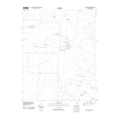
2010 Map of Foraker North
USGS Topo · Published 2010About this map
Saint Johns Cemetery stands as a central landmark in this cattle-country landscape of northern Osage County, where the terrain is defined by an extensive network of small drainages and stock-water management. Ranching infrastructure is prominent, centered around the Adams Ranch Airport and its namesake water bodies, Adams Ranch Airport Lake and Adams Lake. The landscape is a complex watershed where numerous tributaries such as Acker Creek, Salt Creek, and Antelope Creek converge. A modern system of numbered dams, including Oknoname 113052 Dam and Big Caney Creek Site 11 Dam, highlights the 21st-century efforts to manage water resources across this prairie environment, providing essential support for the regional livestock economy.
Find a feature on this map
39 named features on this map. Tap any name to fly to it.
Don’t see what you’re looking for? This feature index may not catch every label — zoom into the map to look around manually.
Map Details
Editions of this 2010 Foraker North Map
This is the sole edition of this map. No revisions or reprints were ever made.
Other maps of this area

1885 · Sedan
USGS Topo · 1:125,000

1889 · Burden
USGS Topo · 1:125,000

1889 · Sedan
USGS Topo · 1:125,000

1909 · Pawhuska
USGS Topo · 1:125,000

1910 · Pawhuska
USGS Topo · 1:125,000

1916 · Foraker
USGS Topo · 1:62,500

1955 · Wichita
USGS Topo · 1:250,000

1955 · Enid
USGS Topo · 1:250,000

1958 · Enid
USGS Topo · 1:250,000

1958 · Wichita
USGS Topo · 1:250,000