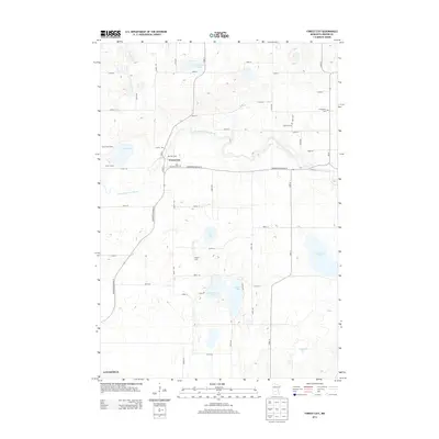
2013 Map of Forest City
USGS Topo · Published 2013About this map
Forest City serves as the focal point of this agricultural landscape in Meeker County, where the meandering North Fork Crow River cuts through a glacial terrain defined by numerous lakes and wetlands. The map documents a deeply rooted rural economy, naming specific family-operated agricultural sites such as Mar Doll Farm, Wagner Dairy, and T and T Farms. These contemporary farmsteads exist alongside long-established community landmarks, including the Saint Gertrude Cem and Ostmark Cem, which offer significant value for genealogical research in the region.
Find a feature on this map
48 named features on this map. Tap any name to fly to it.
Don’t see what you’re looking for? This feature index may not catch every label — zoom into the map to look around manually.
Map Details
Editions of this 2013 Forest City Map
This is the sole edition of this map. No revisions or reprints were ever made.
Other maps of this area

1953 · Saint Cloud
USGS Topo · 1:250,000

1957 · Saint Cloud
USGS Topo · 1:250,000

1958 · Saint Cloud
USGS Topo · 1:250,000

1958 · Dassel
USGS Topo · 1:62,500

1967 · Litchfield South
USGS Topo · 1:24,000

1967 · Litchfield North
USGS Topo · 1:24,000

1967 · Watkins
USGS Topo · 1:24,000

1967 · Kimball
USGS Topo · 1:24,000
1967 · Eden Valley
USGS Topo · 1:24,000
1982 · Dassel
USGS Topo · 1:24,000