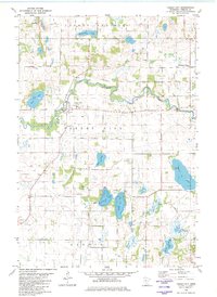
1982 Map of Forest City
USGS Topo · Published 1982About this map
Forest City sits at a bends of the North Fork Crow River, serving as the central hub for this portion of Meeker County. The landscape is a glaciated expanse defined by numerous small water bodies including Rohrbeck Lake, Rice Lake, and the connected waters of Richardson Lake and Dundas Lake. The social fabric of the late 1970s and early 1980s is reflected in several localized places of worship, such as St Gertrude Ch, St Matthews Ch, and the Ostmark Ch.
Find a feature on this map
26 named features on this map. Tap any name to fly to it.
Don’t see what you’re looking for? This feature index may not catch every label — zoom into the map to look around manually.
Map Details
Editions of this 1982 Forest City Map
This is the sole edition of this map. No revisions or reprints were ever made.
Other maps of this area

1953 · Saint Cloud
USGS Topo · 1:250,000

1957 · Saint Cloud
USGS Topo · 1:250,000

1958 · Saint Cloud
USGS Topo · 1:250,000

1958 · Dassel
USGS Topo · 1:62,500

1967 · Litchfield South
USGS Topo · 1:24,000

1967 · Litchfield North
USGS Topo · 1:24,000

1967 · Watkins
USGS Topo · 1:24,000

1967 · Kimball
USGS Topo · 1:24,000
1967 · Eden Valley
USGS Topo · 1:24,000
1982 · Dassel
USGS Topo · 1:24,000