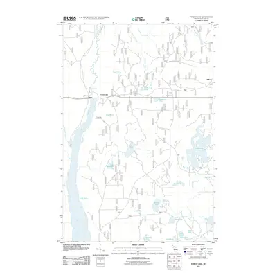
2011 Map of Forest Lake
USGS Topo · Published 2011About this map
The Au Train River and Sturgeon River watersheds dominate this portion of Alger County, where industrial history and conservation efforts converge in the Upper Peninsula. Evidence of early 20th-century labor remains visible at the CCC Camp in the northeast, while the local infrastructure is anchored by the Power Dam near Au Train Falls. Small settlements like Dixon, Vail, and Stillman are scattered along a network of forest roads and truck trails, including the Rapid River Truck Trl, which navigate the dense lake-filled terrain. The southwestern corner is characterized by the expansive Cleveland Cliffs Basin, a significant industrial and geographic landmark. This map reveals a landscape heavily managed for both power generation and forestry, with numerous water bodies such as Joe Lake, Sixteenmile Lake, and Lake Seventeen dotting the map, many accessible only by logging roads and fire trails like Tower Rd.
Find a feature on this map
46 named features on this map. Tap any name to fly to it.
Don’t see what you’re looking for? This feature index may not catch every label — zoom into the map to look around manually.
Map Details
Editions of this 2011 Forest Lake Map
This is the sole edition of this map. No revisions or reprints were ever made.
Other maps of this area

1958 · Corner Lake
USGS Topo · 1:62,500

1958 · Trenary
USGS Topo · 1:62,500

1958 · Munising
USGS Topo · 1:62,500

1958 · Au Train
USGS Topo · 1:62,500

1958 · Marquette
USGS Topo · 1:250,000

1960 · Marquette
USGS Topo · 1:250,000

1961 · Marquette
USGS Topo · 1:250,000

1968 · Marquette
USGS Topo · 1:250,000

1983 · Munising
USGS Topo · 1:100,000
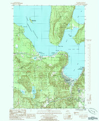
1985 · Munising
USGS Topo · 1:24,000