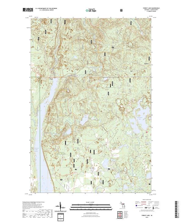
2023 Map of Forest Lake
USGS Topo · Published 2023About this map
Hiawatha National Forest dominates this section of Alger County, where a dense network of water bodies and recreational paths define the Upper Peninsula landscape. The western portion of the map is centered on the Cleveland Cliffs Basin, a major water feature fed by the Au Train River. Several distinct settlements including Dixon, Stillman, and Vail are positioned near established transit corridors like the Coalwood Grade Atv Trl.
Find a feature on this map
32 named features on this map. Tap any name to fly to it.
Don’t see what you’re looking for? This feature index may not catch every label — zoom into the map to look around manually.
Map Details
Editions of this 2023 Forest Lake Map
This is the sole edition of this map. No revisions or reprints were ever made.
Other maps of this area

1958 · Corner Lake
USGS Topo · 1:62,500

1958 · Trenary
USGS Topo · 1:62,500

1958 · Munising
USGS Topo · 1:62,500

1958 · Au Train
USGS Topo · 1:62,500

1958 · Marquette
USGS Topo · 1:250,000

1960 · Marquette
USGS Topo · 1:250,000

1961 · Marquette
USGS Topo · 1:250,000

1968 · Marquette
USGS Topo · 1:250,000

1983 · Munising
USGS Topo · 1:100,000
1985 · Munising
USGS Topo · 1:24,000