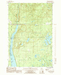
1985 Map of Forest Lake
USGS Topo · Published 1985About this map
Au Train River and its accompanying Au Train Basin dominate this mid-1980s landscape in Michigan's Upper Peninsula. The area serves as a confluence of water and forest management, where the Au Train Falls Power Plant and an Earth Dam mark the intersection of industrial utility and natural resources. This period reflects the dual usage of the land within the Hiawatha National Forest and Escanaba River State Forest, highlighting a transition from the logging era to modern recreation and conservation.
Find a feature on this map
42 named features on this map. Tap any name to fly to it.
Don’t see what you’re looking for? This feature index may not catch every label — zoom into the map to look around manually.
Map Details
Editions of this 1985 Forest Lake Map
This is the sole edition of this map. No revisions or reprints were ever made.
Other maps of this area

1958 · Corner Lake
USGS Topo · 1:62,500

1958 · Trenary
USGS Topo · 1:62,500

1958 · Munising
USGS Topo · 1:62,500

1958 · Au Train
USGS Topo · 1:62,500

1958 · Marquette
USGS Topo · 1:250,000

1960 · Marquette
USGS Topo · 1:250,000

1961 · Marquette
USGS Topo · 1:250,000

1968 · Marquette
USGS Topo · 1:250,000

1983 · Munising
USGS Topo · 1:100,000
1985 · Munising
USGS Topo · 1:24,000