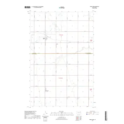
2017 Map of Forest River
USGS Topo · Published 2017About this map
Forest River and Johnstown serve as the primary hubs in this agricultural landscape straddling the border of Walsh and Grand Forks counties. The map documents a highly structured section-line road network, where routes like Co Rd 2 and 145th Ave NE bisect the expansive prairie. The eponymous Forest River meanders through the northern portion of the quadrangle, its natural curves providing a sharp visual contrast to the rigid geometry of the surrounding township and range survey lines. This 2017 survey reflects the persistent importance of water management in the Red River Valley, evidenced by features such as County-Ditch-Number-19. For local historians and genealogists, the Memorial Park Cem and the specific street layouts of the small settlements offer precise points for tracing family sites and property boundaries in this corner of North Dakota.
Find a feature on this map
32 named features on this map. Tap any name to fly to it.
Don’t see what you’re looking for? This feature index may not catch every label — zoom into the map to look around manually.
Map Details
Editions of this 2017 Forest River Map
This is the sole edition of this map. No revisions or reprints were ever made.
Other maps of this area

1926 · Ardoch
USGS Topo · 1:62,500

1943 · Grafton
USGS Topo · 1:62,500

1952 · Thief River Falls
USGS Topo · 1:250,000

1956 · Thief River Falls
USGS Topo · 1:250,000

1957 · Thief River Falls
USGS Topo · 1:250,000

1963 · Inkster NE
USGS Topo · 1:24,000

1963 · Veseleyville
USGS Topo · 1:24,000
1963 · Forest River
USGS Topo · 1:24,000
1963 · Inkster SE
USGS Topo · 1:24,000
1963 · Gilby
USGS Topo · 1:24,000