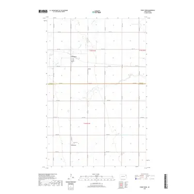
2020 Map of Forest River
USGS Topo · Published 2020About this map
The Forest River meanders through the northern reaches of this landscape, carving a natural path across the township grid. This 2020 survey highlights a distinctly agrarian region where the settlements of Forest River and Johnstown serve as focal points for the surrounding rural community. The map reveals a highly structured environment defined by a dense network of section-line roads, including 145th Ave NE and 36th Ave NE, which facilitate movement between the vast agricultural plots.
Find a feature on this map
33 named features on this map. Tap any name to fly to it.
Don’t see what you’re looking for? This feature index may not catch every label — zoom into the map to look around manually.
Map Details
Editions of this 2020 Forest River Map
This is the sole edition of this map. No revisions or reprints were ever made.
Other maps of this area

1926 · Ardoch
USGS Topo · 1:62,500

1943 · Grafton
USGS Topo · 1:62,500

1952 · Thief River Falls
USGS Topo · 1:250,000

1956 · Thief River Falls
USGS Topo · 1:250,000

1957 · Thief River Falls
USGS Topo · 1:250,000

1963 · Inkster NE
USGS Topo · 1:24,000

1963 · Veseleyville
USGS Topo · 1:24,000
1963 · Forest River
USGS Topo · 1:24,000
1963 · Inkster SE
USGS Topo · 1:24,000
1963 · Gilby
USGS Topo · 1:24,000