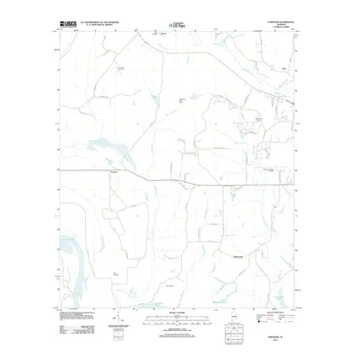
2011 Map of Forester
USGS Topo · Published 2011About this map
Autauga Creek and its many tributaries, including Bear Creek and Noland Creek, define the landscape of this region north of Prattville. The area is marked by a network of small settlements and family-linked landmarks, including the communities of Forester, Wadsworth, and Booth. Genealogists will find a significant concentration of burial sites, such as the DeJarnett Cemetery, Indian Hill Cemetery, and Fair Cemetery, which provide geographical anchors for local family histories. The presence of the Autauga County Airport and the Idlewood Lake Dam indicate the modern infrastructure integrated into this rural Alabama setting. Along the southern edge, the Gun Island Chute provides a clear view of the water channels branching from the larger river systems nearby. The map also documents a dense web of local roads like Golson Rd and Village Creek Rd that connect these dispersed rural homesteads and agricultural tracts.
Find a feature on this map
63 named features on this map. Tap any name to fly to it.
Don’t see what you’re looking for? This feature index may not catch every label — zoom into the map to look around manually.
Map Details
Editions of this 2011 Forester Map
This is the sole edition of this map. No revisions or reprints were ever made.
Other maps of this area

1891 · Clanton
USGS Topo · 1:125,000

1901 · Wetumpka
USGS Topo · 1:125,000

1903 · Wetumpka
USGS Topo · 1:125,000

1927 · Montgomery
USGS Topo · 1:48,000

1930 · Montgomery
USGS Topo · 1:62,500

1953 · Montgomery
USGS Topo · 1:250,000

1956 · Montgomery
USGS Topo · 1:250,000

1957 · Montgomery
USGS Topo · 1:250,000

1957 · Autaugaville
USGS Topo · 1:62,500

1958 · Montgomery
USGS Topo · 1:62,500