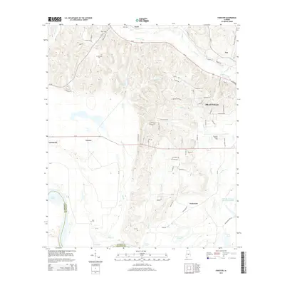
2014 Map of Forester
USGS Topo · Published 2014About this map
Autauga Creek and its many tributaries, including Breakfast Cr and Bridge Cr, define the drainage patterns of this Autauga County landscape. The area north of the Autauga Co and Lowndes Co line shows a transition from the rolling elevations near Booth down toward the wetlands and oxbows of the Alabama River floodplain, represented here by Cooter Pond. Local history and genealogy are anchored by several family-named landmarks and resting places, such as Booth Cem, DeJarnett Cem, and Fair Cem. Transport in the region is dominated by the Us-82 corridor and Al-14, which connect smaller settlements like Forester and Wadsworth to the growing western edge of Prattville. The inclusion of Prattville - Grouby Field highlights the local aviation infrastructure serving this part of the state.
Find a feature on this map
83 named features on this map. Tap any name to fly to it.
Don’t see what you’re looking for? This feature index may not catch every label — zoom into the map to look around manually.
Map Details
Editions of this 2014 Forester Map
This is the sole edition of this map. No revisions or reprints were ever made.
Other maps of this area

1891 · Clanton
USGS Topo · 1:125,000

1901 · Wetumpka
USGS Topo · 1:125,000

1903 · Wetumpka
USGS Topo · 1:125,000

1927 · Montgomery
USGS Topo · 1:48,000

1930 · Montgomery
USGS Topo · 1:62,500

1953 · Montgomery
USGS Topo · 1:250,000

1956 · Montgomery
USGS Topo · 1:250,000

1957 · Montgomery
USGS Topo · 1:250,000

1957 · Autaugaville
USGS Topo · 1:62,500

1958 · Montgomery
USGS Topo · 1:62,500