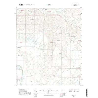
2020 Map of Forester
USGS Topo · Published 2020About this map
Autauga Cr carves a winding path through the rolling hills of Autauga County, anchoring a landscape where small communities like Forester and Wadsworth persist alongside modern growth in Prattville. This 2020 survey reveals a deep layer of local history preserved in its rural corners, from the family and community plots at Indian Hill Cem and De Jarnett Cemetery to the educational grounds of Autauga Academy. The terrain transitions from the upland ridges near Booth to the expansive wetlands of Bear Swamp and Bear Creek Swamp in the south. Aviation and infrastructure are represented by Prattville - Grouby Field and the northern reach of the R E "Bob" Woodruff Reservoir, while numerous small water bodies like Idlewild Lake and Robinson Pond define the drainage patterns of this Central Alabama region.
Find a feature on this map
101 named features on this map. Tap any name to fly to it.
Don’t see what you’re looking for? This feature index may not catch every label — zoom into the map to look around manually.
Map Details
Editions of this 2020 Forester Map
This is the sole edition of this map. No revisions or reprints were ever made.
Other maps of this area

1891 · Clanton
USGS Topo · 1:125,000

1901 · Wetumpka
USGS Topo · 1:125,000

1903 · Wetumpka
USGS Topo · 1:125,000

1927 · Montgomery
USGS Topo · 1:48,000

1930 · Montgomery
USGS Topo · 1:62,500

1953 · Montgomery
USGS Topo · 1:250,000

1956 · Montgomery
USGS Topo · 1:250,000

1957 · Montgomery
USGS Topo · 1:250,000

1957 · Autaugaville
USGS Topo · 1:62,500

1958 · Montgomery
USGS Topo · 1:62,500