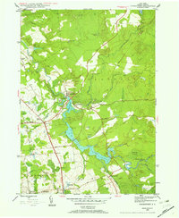
1945 Map of Forestport
USGS Topo · Published 1960About this map
The Black River corridor defines the landscape of this 1945 survey, where the river's flow is managed by the Forestport Reservoir and the expansive Kayuta Lake. In this era, the New York Central railroad serves as the primary backbone of the region, connecting the village of Forestport with outlying points like Alder Creek Sta. The map reveals a community structured around rural industry and faith, evidenced by landmarks such as Bardwell Mill and the French Road Ch. Local education is anchored by School No 18, while several cemeteries including Brooks Cem and the Catholic Cem provide valuable touchpoints for family historians. The surrounding terrain transitions into the dense woods of the Forestport area, marked by numerous water bodies like Woodhull Creek and the remote Tamarack Swamp.
Find a feature on this map
40 named features on this map. Tap any name to fly to it.
Don’t see what you’re looking for? This feature index may not catch every label — zoom into the map to look around manually.
Map Details
Editions of this 1945 Forestport Map
4 editions found
Other maps of this area

1897 · Remsen
USGS Topo · 1:62,500

1900 · Remsen
USGS Topo · 1:62,500

1904 · Boonville
USGS Topo · 1:62,500

1905 · Port Leyden
USGS Topo · 1:62,500

1907 · Port Leyden
USGS Topo · 1:62,500

1912 · Mc Keever
USGS Topo · 1:62,500

1940 · Port Leyden
USGS Topo · 1:62,500

1945 · Boonville
USGS Topo · 1:24,000

1945 · Forestport
USGS Topo · 1:24,000
1946 · Hinckley
USGS Topo · 1:25,000