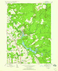
1945 Map of Forestport
USGS Topo · Published 1960About this map
Black River and Kayuta Lake dominate this mid-century landscape in Oneida County, where the village of Forestport serves as a central hub for the surrounding rural communities. The map captures a moment when the New York Central railroad was vital to the region, with dedicated stops at Alder Creek Sta and Forestport Sta. The survey provides excellent detail for genealogical research, documenting several local burial grounds such as Brooks Cem and the Catholic Cem, alongside rural landmarks like Bethel Ch and School No 18. A notable aviation feature, the Landing Field, sits near the river's bend, while the eastern portion of the quadrangle transitions into the dense woods of the Forestport region and the Tamarack Swamp. Smaller hamlets like Honnidaga and Alder Creek are connected by a network of local thoroughfares including Dayton Road and Dustin Road.
Find a feature on this map
37 named features on this map. Tap any name to fly to it.
Don’t see what you’re looking for? This feature index may not catch every label — zoom into the map to look around manually.
Map Details
Editions of this 1945 Forestport Map
4 editions found
Other maps of this area

1897 · Remsen
USGS Topo · 1:62,500

1900 · Remsen
USGS Topo · 1:62,500

1904 · Boonville
USGS Topo · 1:62,500

1905 · Port Leyden
USGS Topo · 1:62,500

1907 · Port Leyden
USGS Topo · 1:62,500

1912 · Mc Keever
USGS Topo · 1:62,500

1940 · Port Leyden
USGS Topo · 1:62,500

1945 · Boonville
USGS Topo · 1:24,000

1945 · Forestport
USGS Topo · 1:24,000
1946 · Hinckley
USGS Topo · 1:25,000