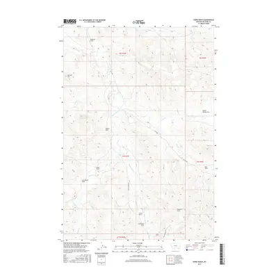
2017 Map of Forks Ranch
USGS Topo · Published 2017About this map
Hanging Woman Cr meanders through the heart of this Big Horn County landscape, carving a primary drainage route through a complex series of ridges and draws. The eponymous Forks Ranch is situated in the southern portion of the map at the junction of Hanging Woman Rd and Padlock Ranch Rd. This area is defined by its dramatic elevation changes, punctuated by high points such as Hellers Peak and Hampton Butte, which rise above the surrounding drainages.
Find a feature on this map
28 named features on this map. Tap any name to fly to it.
Don’t see what you’re looking for? This feature index may not catch every label — zoom into the map to look around manually.
Map Details
Editions of this 2017 Forks Ranch Map
This is the sole edition of this map. No revisions or reprints were ever made.
Other maps of this area

1909 · Sheridan
USGS Topo · 1:125,000

1911 · Sheridan
USGS Topo · 1:125,000

1954 · Hardin
USGS Topo · 1:250,000

1955 · Sheridan
USGS Topo · 1:250,000

1957 · Hardin
USGS Topo · 1:250,000

1958 · Hardin
USGS Topo · 1:250,000

1958 · Sheridan
USGS Topo · 1:250,000

1962 · Sheridan
USGS Topo · 1:250,000

1967 · Lacey Gulch
USGS Topo · 1:24,000
1967 · Pine Butte School
USGS Topo · 1:24,000