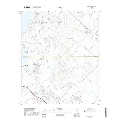
2019 Map of Forney North
USGS Topo · Published 2019About this map
Ray Hubbard Lake dominates the western edge of this landscape, marking the suburban expansion where Dallas and Rockwall converge. The terrain is defined by a dense network of residential development transitioning into the rural reaches of Kaufman County. Numerous smaller water bodies like University Park Lake and the winding Mustang Cr drain the eastern half of the quadrangle, where the communities of McLendon-Chisholm and Heath reflect modern growth patterns over former ranch land.
Find a feature on this map
218 named features on this map. Tap any name to fly to it.
Don’t see what you’re looking for? This feature index may not catch every label — zoom into the map to look around manually.
Map Details
Editions of this 2019 Forney North Map
This is the sole edition of this map. No revisions or reprints were ever made.
Other maps of this area

1891 · Dallas
USGS Topo · 1:125,000

1893 · Dallas
USGS Topo · 1:125,000

1912 · Rockwall
USGS Topo · 1:31,680

1919 · Royse City
USGS Topo · 1:62,500

1954 · Dallas
USGS Topo · 1:250,000

1956 · Kaufman
USGS Topo · 1:62,500

1958 · Dallas
USGS Topo · 1:250,000

1959 · Mesquite
USGS Topo · 1:24,000

1959 · Seagoville
USGS Topo · 1:24,000
1959 · Rowlett
USGS Topo · 1:24,000