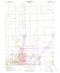
1967 Map of Forsyth
USGS Topo · Published 1976About this map
Decatur's northern expansion is clearly visible in this mid-1960s study, which shows the development of residential neighborhoods like Larkdale and Cresthaven Country Club pushing into the farmland of Hickory Point and Whitmore. The northern edge of the city is characterized by educational and institutional growth, including the Stephen Decatur High Sch, Mound Jr High Sch, and the Adlai E Stevenson Sch. The era's transportation infrastructure is anchored by the Illinois Central Pennsylvania railroad corridor, which links the industrial hub of Decatur to the outlying grain elevators at Emery and the growing village of Forsyth.
Find a feature on this map
47 named features on this map. Tap any name to fly to it.
Don’t see what you’re looking for? This feature index may not catch every label — zoom into the map to look around manually.
Map Details
Editions of this 1967 Forsyth Map
2 editions found
Other maps of this area

1929 · Decatur
USGS Topo · 1:62,500

1933 · Decatur
USGS Topo · 1:62,500

1954 · Niantic
USGS Topo · 1:62,500

1957 · Kenney
USGS Topo · 1:62,500

1957 · Maroa
USGS Topo · 1:62,500

1958 · Peoria
USGS Topo · 1:250,000

1958 · Decatur
USGS Topo · 1:250,000

1961 · Peoria
USGS Topo · 1:250,000

1961 · Decatur
USGS Topo · 1:250,000

1963 · Peoria
USGS Topo · 1:250,000