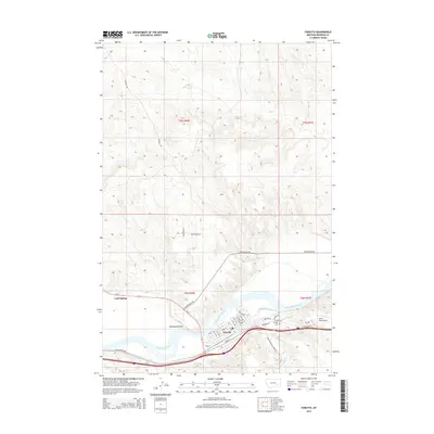
2014 Map of Forsyth
USGS Topo · Published 2014About this map
The Yellowstone River winds through the heart of this region, shaping the development of Forsyth and the surrounding agricultural lands. This 2014 survey documents the established street grid of the county seat, where thoroughfares like Front St and Main St parallel the riverbanks. To the west, the valley widens into Hammond Valley, while the north is defined by a more dissected landscape of drainage coulees including Dry Cr and Short Cr. Local aviation and history are represented by Tillitt Field Airport and the Forsyth Cem, situated near the confluence of the river and Slaughterhouse Cr. The map details the transition between older travel routes like Old Highway 10E and modern infrastructure, providing a clear view of the area's transportation network from the river valley to the upland ranch roads like Gerhart Rd.
Find a feature on this map
37 named features on this map. Tap any name to fly to it.
Don’t see what you’re looking for? This feature index may not catch every label — zoom into the map to look around manually.
Map Details
Editions of this 2014 Forsyth Map
This is the sole edition of this map. No revisions or reprints were ever made.
Other maps of this area

1954 · Forsyth
USGS Topo · 1:250,000

1957 · Forsyth
USGS Topo · 1:250,000

1958 · Forsyth
USGS Topo · 1:250,000

1968 · Orinoco
USGS Topo · 1:24,000

1968 · Nichols
USGS Topo · 1:24,000

1968 · Forsyth
USGS Topo · 1:24,000

1968 · Schultz Coulee
USGS Topo · 1:24,000

1968 · Finch NE
USGS Topo · 1:24,000

1968 · Black Coulee
USGS Topo · 1:24,000

1971 · Griffin Coulee NE
USGS Topo · 1:24,000