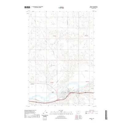
2020 Map of Forsyth
USGS Topo · Published 2020About this map
The Yellowstone River cuts through the southern portion of this landscape, serving as the historical and economic anchor for the community of Forsyth. As the Rosebud County seat, the town is defined by its organized grid of streets such as Front St and Main St, centered around the Rosebud County Courthouse. The valley floor near Hammond Valley transitions into the upland breaks to the north, where names like Little Porcupine Creek Rd and Gerhardt Rd trace the drainage patterns of Dry Cr and Short Cr. In the southeast, Tillitt Field and the Forsyth Cem mark the edges of the settlement, while the path of Old US Hwy 10 indicates the area's legacy as a regional transportation corridor along the river bluffs.
Find a feature on this map
40 named features on this map. Tap any name to fly to it.
Don’t see what you’re looking for? This feature index may not catch every label — zoom into the map to look around manually.
Map Details
Editions of this 2020 Forsyth Map
This is the sole edition of this map. No revisions or reprints were ever made.
Other maps of this area

1954 · Forsyth
USGS Topo · 1:250,000

1957 · Forsyth
USGS Topo · 1:250,000

1958 · Forsyth
USGS Topo · 1:250,000

1968 · Orinoco
USGS Topo · 1:24,000

1968 · Nichols
USGS Topo · 1:24,000

1968 · Forsyth
USGS Topo · 1:24,000

1968 · Schultz Coulee
USGS Topo · 1:24,000

1968 · Finch NE
USGS Topo · 1:24,000

1968 · Black Coulee
USGS Topo · 1:24,000

1971 · Griffin Coulee NE
USGS Topo · 1:24,000