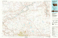
1984 Map of Fort Benton
USGS Topo · Published 1984About this map
The confluence of the Missouri River, Teton River, and Marias River at Loma anchor this mid-1980s landscape, illustrating the vital hydrology of north-central Montana. The city of Fort Benton serves as the historic hub, where the river's path is carved through deep coulees and marked by significant landmarks like Roosevelt Island and Cottonwood Bottom. The era is defined by the coexistence of working transportation corridors, such as the Burlington Northern Railroad Grade, and protected lands including the Upper Missouri River Wild and Scenic River. To the south, the terrain rises into the Highwood Mountains, featuring prominent peaks like Highwood Baldy and Goat Mountain. Distinctive geological formations, from the Chalk Cliffs to the iconic Square Butte, reflect a region shaped by both ancient erosion and modern agricultural development, seen in the numerous reservoirs and landing strips dotting the plains near Geraldine and Montague.
Find a feature on this map
98 named features on this map. Tap any name to fly to it.
Don’t see what you’re looking for? This feature index may not catch every label — zoom into the map to look around manually.
Map Details
Editions of this 1984 Fort Benton Map
This is the sole edition of this map. No revisions or reprints were ever made.
Other maps of this area

1886 · Great Falls
USGS Topo · 1:250,000

1890 · Fort Benton
USGS Topo · 1:250,000

1892 · Fort Benton
USGS Topo · 1:250,000

1897 · Fort Benton
USGS Topo · 1:250,000

1919 · Big Sandy
USGS Topo · 1:125,000

1948 · Portage
USGS Topo · 1:62,500

1949 · Portage
USGS Topo · 1:62,500

1950 · Dent Bridge
USGS Topo · 1:62,500

1953 · Boggs Island
USGS Topo · 1:24,000

1953 · Rocky Lake
USGS Topo · 1:24,000