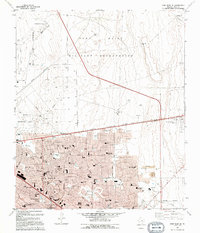
1994 Map of Fort Bliss SE
USGS Topo · Published 1994About this map
Fort Bliss Military Reservation dominates the northern half of this landscape, characterized by the expansive Biggs Army Airfield and numerous radio facilities. To the south, the city of El Paso expands toward the Corporate Boundary, showing the dense suburban development of the 1990s. The transition from the high desert terrain of Jesuit Draw to the residential streets of Hacienda Heights and Del Norte Heights reveals the rapid urbanization of the area. Educational and social landmarks are densely packed here, including the El Paso Community College (Valle Verde Campus), J M Hanks High Sch, and the Vista Hills Country Club. Genealogical interest is found in the east at Evergreen Cemetery East, while the northern military lands contain a Federal Prison Camp and various lookout points, highlighting the strategic and institutional character of this borderland city.
Find a feature on this map
51 named features on this map. Tap any name to fly to it.
Don’t see what you’re looking for? This feature index may not catch every label — zoom into the map to look around manually.
Map Details
Editions of this 1994 Fort Bliss SE Map
This is the sole edition of this map. No revisions or reprints were ever made.
Other maps of this area

1896 · El Paso
USGS Topo · 1:125,000

1908 · El Paso
USGS Topo · 1:125,000

1939 · Ysleta
USGS Topo · 1:62,500

1939 · Heuco Tanks
USGS Topo · 1:62,500

1940 · Heuco Tanks
USGS Topo · 1:62,500

1941 · El Paso
USGS Topo · 1:31,680

1941 · Clint
USGS Topo · 1:62,500

1941 · Ysleta
USGS Topo · 1:62,500

1942 · Fort Bliss
USGS Topo · 1:62,500

1943 · El Paso
USGS Topo · 1:31,680
Featured Places
- El Paso, TX
- Turf Estates Number 1 Colonia, TX
- Las Palmas Number 2 Colonia, El Paso
- Las Palmas Colonia, El Paso
- Del Norte Heights, El Paso