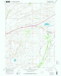
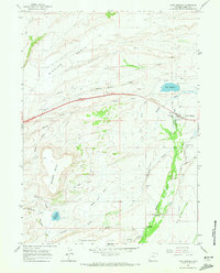
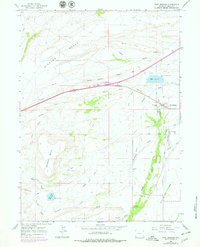
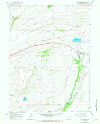
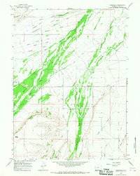
1964 Map of Fort Bridger
USGS Topo · Published 1979About this map
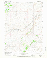
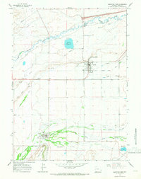
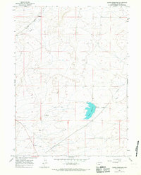
The Emigrant Trail carves a diagonal path across this high desert landscape, tracing the historic movement of pioneers through southwest Wyoming. Centered on the famous Fort Bridger outpost, the map captures a crossroads of history where the old trail intersects with modern energy infrastructure like the long Pipelines running north of the settlement. The importance of water management in this arid region is clearly visible through an extensive network of irrigation, including the Pine Grove Canal, Austin Canal, and prominent holdings like Wall Reservoir.
Find a feature on this map
32 named features on this map. Tap any name to fly to it.
Don’t see what you’re looking for? This feature index may not catch every label — zoom into the map to look around manually.
Map Details
Editions of this 1964 Fort Bridger Map
4 editions found
Other maps of this area

1954 · Ogden
USGS Topo · 1:250,000

1958 · Ogden
USGS Topo · 1:250,000

1960 · Ogden
USGS Topo · 1:250,000
1964 · Fort Bridger
USGS Topo · 1:24,000
1964 · Carter
USGS Topo · 1:24,000
1964 · Mountain View
USGS Topo · 1:24,000
1964 · Austin Reservoir
USGS Topo · 1:24,000
1964 · Leavitt Bench
USGS Topo · 1:24,000
1964 · Robertson
USGS Topo · 1:24,000
1965 · Bridger
USGS Topo · 1:24,000