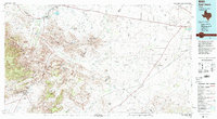
1985 Map of Fort Davis
USGS Topo · Published 1994About this map
Limpia Creek and Musquiz Creek carve through the high elevations of the Trans-Pecos, where the Barrilla Mountains rise above the surrounding flats. This 1980s landscape is defined by the contrast between the high desert peaks and the spring-fed waters of the Balmorhea State Park region. Water management is a primary feature of the northeastern lowlands, evidenced by an intricate network of the Main Canal, Feeder Canal, and Phantom Lake Canal serving the area near Balmorhea Lake.
Find a feature on this map
88 named features on this map. Tap any name to fly to it.
Don’t see what you’re looking for? This feature index may not catch every label — zoom into the map to look around manually.
Map Details
Editions of this 1985 Fort Davis Map
2 editions found
Other maps of this area

1894 · Valentine
USGS Topo · 1:125,000

1894 · Fort Davis
USGS Topo · 1:125,000

1895 · Marfa
USGS Topo · 1:125,000

1895 · Alpine
USGS Topo · 1:125,000

1897 · Valentine
USGS Topo · 1:125,000

1897 · Fort Davis
USGS Topo · 1:125,000

1920 · Longfellow
USGS Topo · 1:125,000

1921 · Toyah
USGS Topo · 1:125,000

1921 · Fort Stockton
USGS Topo · 1:62,500

1923 · Fort Stockton
USGS Topo · 1:62,500