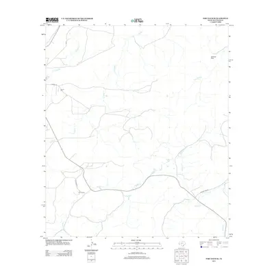
2012 Map of Fort Davis SE
USGS Topo · Published 2012About this map
Camp Musquiz and the high desert terrain of the Davis Mountains define this corner of Jeff Davis County. The landscape is carved by a complex network of ephemeral waterways, including the winding Musquiz Cr and Cienega Cr, which dictate the paths of local travel along High Frontier and Kokernot Creek Rd. To the northeast, the prominent Arkansas Mesa stands as a significant topographic landmark overlooking the drainage basins of Horse Thief Cr and Kokernot Cr.
Find a feature on this map
13 named features on this map. Tap any name to fly to it.
Don’t see what you’re looking for? This feature index may not catch every label — zoom into the map to look around manually.
Map Details
Editions of this 2012 Fort Davis SE Map
This is the sole edition of this map. No revisions or reprints were ever made.
Other maps of this area

1894 · Fort Davis
USGS Topo · 1:125,000

1895 · Alpine
USGS Topo · 1:125,000

1897 · Fort Davis
USGS Topo · 1:125,000

1954 · Fort Stockton
USGS Topo · 1:250,000

1958 · Fort Stockton
USGS Topo · 1:250,000

1972 · Casket Mountain
USGS Topo · 1:24,000

1972 · Swayback Mountain
USGS Topo · 1:24,000
1972 · Fort Davis SE
USGS Topo · 1:24,000

1972 · Alpine North
USGS Topo · 1:24,000
1972 · Fort Davis
USGS Topo · 1:24,000