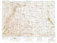
1954 Map of Fort Dodge
USGS Topo · Published 1976About this map
The Des Moines River and its forks define the drainage of this north-central Iowa region during the mid-1950s. Fort Dodge serves as a major hub for industry and transportation, evidenced by the extensive Illinois Central Gulf and Chicago & North Western rail networks that crisscross the prairie. The landscape is dotted with small agricultural settlements like Pocahontas, Laurens, and Humboldt, each linked by the emerging post-war highway system including U.S. 20 and U.S. 169.
Find a feature on this map
199 named features on this map. Tap any name to fly to it.
Don’t see what you’re looking for? This feature index may not catch every label — zoom into the map to look around manually.
Map Details
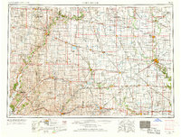
Editions of this 1954 Fort Dodge Map
3 editions found

Other maps of this area

1911 · Madrid
USGS Topo · 1:62,500

1914 · Madrid
USGS Topo · 1:62,500

1916 · Boone
USGS Topo · 1:62,500

1923 · Lehigh
USGS Topo · 1:62,500

1923 · Fort Dodge
USGS Topo · 1:62,500

1950 · Perry
USGS Topo · 1:62,500

1951 · Perry
USGS Topo · 1:62,500

1951 · Ogden
USGS Topo · 1:62,500

1954 · Bagley
USGS Topo · 1:62,500

1954 · Fairmont
USGS Topo · 1:250,000