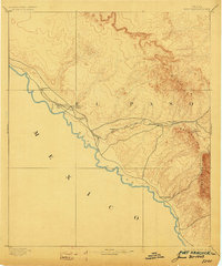
1894 Map of Fort Hancock
USGS Topo · Published 1903About this map
The Rio Grande marks the southern boundary of this borderlands survey, where the Galveston Harrisburg and San Antonio Railway parallels the river across the high desert. This era of military transition is clearly visible, showing the shift from frontier defenses to railroad-oriented settlements. While Fort Hancock Post and Fort Hancock Station remain active hubs, several earlier installations are already recorded as abandoned, reflecting the changing nature of Texas border security at the turn of the century.
Find a feature on this map
18 named features on this map. Tap any name to fly to it.
Don’t see what you’re looking for? This feature index may not catch every label — zoom into the map to look around manually.
Map Details
Editions of this 1894 Fort Hancock Map
4 editions found
Other maps of this area

1894 · Fort Hancock
USGS Topo · 1:125,000

1895 · Sierra Blanca
USGS Topo · 1:125,000

1896 · El Paso
USGS Topo · 1:125,000

1896 · Rio Grande
USGS Topo · 1:125,000

1897 · Eagle Mountain
USGS Topo · 1:125,000

1903 · Cerro Alto
USGS Topo · 1:125,000

1908 · El Paso
USGS Topo · 1:125,000

1916 · Eagle Mountain
USGS Topo · 1:125,000

1941 · Clint
USGS Topo · 1:62,500

1941 · Tornillo
USGS Topo · 1:62,500