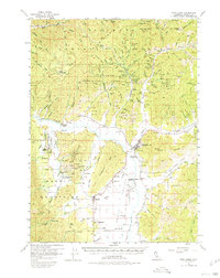
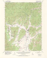
1955 Map of Fort Jones
USGS Topo · Published 1980About this map
Fort Jones stands as the primary hub in this mid-century survey of the Scott River valley and the surrounding Klamath National Forest. The landscape reveals a complex history of resource extraction, with numerous hydraulic and hard-rock operations such as the Providence Mine, Sheba Mine, and Cherry Hill Mine dotting the drainages of the Marble Mountains. Settlement patterns are concentrated along the valley floor, where small communities like Greenview, Oro Fino, and the evocatively named Mugginsville are connected by a network of rural routes including Eller Lane and Patent Lane.
Find a feature on this map
130 named features on this map. Tap any name to fly to it.
Don’t see what you’re looking for? This feature index may not catch every label — zoom into the map to look around manually.
Map Details
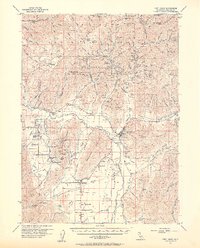
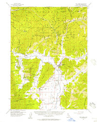
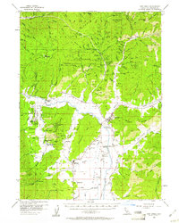
Editions of this 1955 Fort Jones Map
5 editions found
Other maps of this area

1886 · Shasta
USGS Topo · 1:250,000

1894 · Shasta
USGS Topo · 1:250,000

1914 · Seiad
USGS Topo · 1:125,000

1922 · Seiad
USGS Topo · 1:125,000

1923 · Sawyers Bar
USGS Topo · 1:125,000

1931 · Etna
USGS Topo · 1:96,000

1932 · Yreka
USGS Topo · 1:96,000

1934 · Etna
USGS Topo · 1:125,000
1939 · Yreka
USGS Topo · 1:125,000

1948 · Weed
USGS Topo · 1:250,000