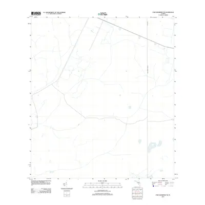
2012 Map of Fort Kissimmee NE
USGS Topo · Published 2012About this map
Pine Island Slough dominates the southern reaches of this landscape, marking a typical Floridian drainage pattern through the low-lying terrain of Osceola County. The area remains largely undeveloped, defined by a sparse network of rural routes and primitive trails. Notable corridors include Peavine Trl and the uniquely named Corn Hornet Guide Rd, which provide access through the interior. The map reflects a quiet, transitional environment where the hydrological signatures of sloughs and small, scattered water bodies dictate the layout of the few existing roads. This survey serves as a clear record of the region's preservation and limited human footprint at the start of the 2010s.
Find a feature on this map
3 named features on this map. Tap any name to fly to it.
Don’t see what you’re looking for? This feature index may not catch every label — zoom into the map to look around manually.
Map Details
Editions of this 2012 Fort Kissimmee NE Map
This is the sole edition of this map. No revisions or reprints were ever made.
Other maps of this area

1952 · Fort Kissimmee
USGS Topo · 1:24,000

1952 · Fort Kissimmee NW
USGS Topo · 1:24,000

1953 · Fort Kissimmee NE
USGS Topo · 1:24,000

1953 · Fort Drum SW
USGS Topo · 1:24,000

1953 · Lake Marian SE
USGS Topo · 1:24,000

1953 · Fort Drum NW
USGS Topo · 1:24,000

1953 · Kenansville SW
USGS Topo · 1:24,000

1953 · Lake Marian SW
USGS Topo · 1:24,000

1953 · Fort Kissimmee SE
USGS Topo · 1:24,000

1956 · Fort Pierce
USGS Topo · 1:250,000