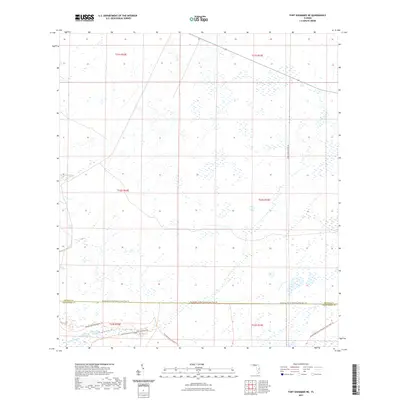
2021 Map of Fort Kissimmee NE
USGS Topo · Published 2021About this map
Pine Island Slough and the surrounding Dead Pine Island Marsh define the hydrologic character of this Central Florida landscape. Located at the boundary of Osceola and Okeechobee counties, this 2021 survey reveals a territory primarily preserved for conservation and public recreation. The southern portion of the sheet is traversed by the Florida National Scenic Trail, a major corridor for hikers that intersects with the localized Kissimmee Prairie Preserve State Park Trail. This network of paths suggests the area's importance as a sanctuary for native Florida prairie ecosystems.
Find a feature on this map
13 named features on this map. Tap any name to fly to it.
Don’t see what you’re looking for? This feature index may not catch every label — zoom into the map to look around manually.
Map Details
Editions of this 2021 Fort Kissimmee NE Map
This is the sole edition of this map. No revisions or reprints were ever made.
Other maps of this area

1952 · Fort Kissimmee
USGS Topo · 1:24,000

1952 · Fort Kissimmee NW
USGS Topo · 1:24,000

1953 · Fort Kissimmee NE
USGS Topo · 1:24,000

1953 · Fort Drum SW
USGS Topo · 1:24,000

1953 · Lake Marian SE
USGS Topo · 1:24,000

1953 · Fort Drum NW
USGS Topo · 1:24,000

1953 · Kenansville SW
USGS Topo · 1:24,000

1953 · Lake Marian SW
USGS Topo · 1:24,000

1953 · Fort Kissimmee SE
USGS Topo · 1:24,000

1956 · Fort Pierce
USGS Topo · 1:250,000