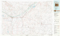
1980 Map of Fort Morgan
USGS Topo · Published 1980About this map
Fort Morgan and the surrounding high plains are defined by the life-giving corridor of the South Platte River, which supports a chain of agricultural settlements including Log Lane Village, Brush, and Hillrose. Compiled from surveys through the early 1970s and edited in 1980, this map illustrates the vital intersection of water and transport. The Union Pacific and Burlington Northern railroads parallel the river and the diagonal reach of the prairie, connecting remote outposts like Akron and Platner to the larger regional economy. Beyond the irrigated valley, the landscape is punctuated by energy extraction, visible in the Vallery Oil Field and Fort Morgan Oil Field. Large water projects like Empire Reservoir and Riverside Reservoir stand out as essential landmarks in this semi-arid region, while smaller locales such as Ninemile Corner and Twelvemile Corner mark the rural grid of northeastern Colorado.
Find a feature on this map
66 named features on this map. Tap any name to fly to it.
Don’t see what you’re looking for? This feature index may not catch every label — zoom into the map to look around manually.
Map Details
Editions of this 1980 Fort Morgan Map
This is the sole edition of this map. No revisions or reprints were ever made.
Other maps of this area

1950 · Wiggins
USGS Topo · 1:24,000

1950 · Hoyt
USGS Topo · 1:24,000

1951 · Hoyt
USGS Topo · 1:24,000

1951 · Weldona
USGS Topo · 1:24,000

1951 · Orchard
USGS Topo · 1:24,000

1951 · Dead Horse Springs
USGS Topo · 1:24,000

1951 · Reiradon Hill
USGS Topo · 1:24,000

1951 · Willard
USGS Topo · 1:24,000

1951 · Messex
USGS Topo · 1:24,000

1951 · Sterling South
USGS Topo · 1:24,000