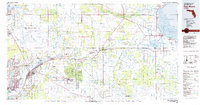
1981 Map of Fort Myers
USGS Topo · Published 1981About this map
The Caloosahatchee River serves as the central artery of this Southwest Florida corridor, flowing from the edge of Lake Okeechobee toward the growing coastal centers of Fort Myers and Cape Coral. By the early 1980s, the landscape reflects a transition from traditional agricultural and water-management systems to large-scale residential development. Inland, the planned community of Lehigh Acres shows its expansive grid, while the Herbert Hoover Dike and Caloosahatchee Waterway illustrate the region's massive hydrological engineering.
Find a feature on this map
74 named features on this map. Tap any name to fly to it.
Don’t see what you’re looking for? This feature index may not catch every label — zoom into the map to look around manually.
Map Details
Editions of this 1981 Fort Myers Map
This is the sole edition of this map. No revisions or reprints were ever made.
Other maps of this area

1953 · Brighton SW
USGS Topo · 1:24,000

1953 · Brighton SE
USGS Topo · 1:24,000

1953 · Okeechobee SW
USGS Topo · 1:24,000

1956 · Arcadia SE
USGS Topo · 1:24,000

1956 · Murdock SE
USGS Topo · 1:24,000

1956 · Telegraph Swamp
USGS Topo · 1:24,000

1956 · Cleveland
USGS Topo · 1:24,000

1956 · Telegraph Swamp NE
USGS Topo · 1:24,000

1956 · Telegraph Swamp NW
USGS Topo · 1:24,000

1956 · Ft. Ogden
USGS Topo · 1:24,000