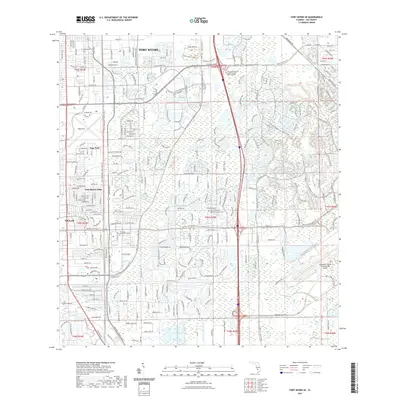
2021 Map of Fort Myers SE
USGS Topo · Published 2021About this map
The suburban development and transport corridors of Lee County take center stage in this 2021 study of Fort Myers and its surrounding communities. The landscape is defined by a dense network of residential subdivisions and commercial centers, including Villas, Page Park, and Fort Myers Villas. This era of the city's growth is anchored by major institutional and recreational landmarks such as the Nova Southeastern University Fort Myers Campus and the extensive Southwest Florida International Airport complex in the southeast.
Find a feature on this map
23 named features on this map. Tap any name to fly to it.
Don’t see what you’re looking for? This feature index may not catch every label — zoom into the map to look around manually.
Map Details
Editions of this 2021 Fort Myers SE Map
This is the sole edition of this map. No revisions or reprints were ever made.
Other maps of this area

1956 · West Palm Beach
USGS Topo · 1:250,000

1957 · West Palm Beach
USGS Topo · 1:250,000

1958 · West Palm Beach
USGS Topo · 1:250,000

1958 · Corkscrew NW
USGS Topo · 1:24,000

1958 · Fort Myers NW
USGS Topo · 1:24,000

1958 · Estero
USGS Topo · 1:24,000

1958 · Fort Myers SW
USGS Topo · 1:24,000

1958 · Olga
USGS Topo · 1:24,000

1958 · Alva SW
USGS Topo · 1:24,000

1958 · Fort Myers
USGS Topo · 1:24,000