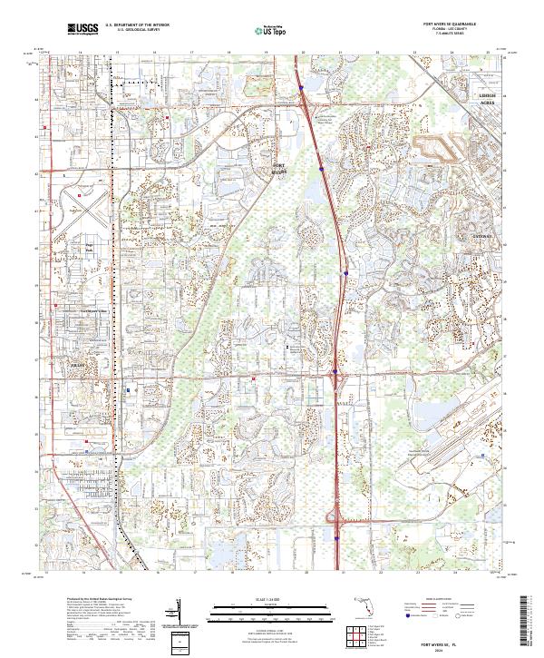
2024 Map of Fort Myers SE
USGS Topo · Published 2024About this map
Fort Myers serves as the focal point for this contemporary survey of Lee County, illustrating the modern convergence of aviation infrastructure and suburban expansion. The eastern portion of the map is dominated by the sprawling grounds of the Southwest Florida International Airport, while Page Field sits to the northwest, highlighting the area's significance as a transportation hub. The landscape is characterized by a dense network of residential developments and planned communities such as Gateway, Lehigh Acres, and Villas.
Find a feature on this map
30 named features on this map. Tap any name to fly to it.
Don’t see what you’re looking for? This feature index may not catch every label — zoom into the map to look around manually.
Map Details
Editions of this 2024 Fort Myers SE Map
This is the sole edition of this map. No revisions or reprints were ever made.
Other maps of this area

1956 · West Palm Beach
USGS Topo · 1:250,000

1957 · West Palm Beach
USGS Topo · 1:250,000

1958 · West Palm Beach
USGS Topo · 1:250,000

1958 · Corkscrew NW
USGS Topo · 1:24,000

1958 · Fort Myers NW
USGS Topo · 1:24,000

1958 · Estero
USGS Topo · 1:24,000

1958 · Fort Myers SW
USGS Topo · 1:24,000

1958 · Olga
USGS Topo · 1:24,000

1958 · Alva SW
USGS Topo · 1:24,000

1958 · Fort Myers
USGS Topo · 1:24,000