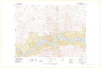
1978 Map of Fort Peck Lake West
USGS Topo · Published 1978About this map
Charles M Russell National Wildlife Range and the Ul Bend National Wildlife Refuge dominate the southern landscape of this 1978 survey, tracing the intricate shoreline and surrounding breaks of Fort Peck Lake. The terrain transitions from the high, flat expanses of the Sun Prairie Flats and Sun Prairie Hills to a labyrinth of deeply eroded coulees. Local landmarks like The Chimneys, Castle Rocks, and Square Butte provide distinctive navigational points amidst the complex drainage patterns of Frenchman Creek and Beaver Creek.
Find a feature on this map
67 named features on this map. Tap any name to fly to it.
Don’t see what you’re looking for? This feature index may not catch every label — zoom into the map to look around manually.
Map Details
Editions of this 1978 Fort Peck Lake West Map
2 editions found

Other maps of this area

1943 · Glasgow
USGS Topo · 1:125,000

1953 · Havre
USGS Topo · 1:250,000

1954 · Jordan
USGS Topo · 1:250,000

1954 · Glasgow
USGS Topo · 1:250,000

1954 · Lewistown
USGS Topo · 1:250,000

1956 · Jordan
USGS Topo · 1:250,000

1957 · Glasgow
USGS Topo · 1:250,000

1957 · Havre
USGS Topo · 1:250,000

1958 · Glasgow
USGS Topo · 1:250,000

1958 · Jordan
USGS Topo · 1:250,000