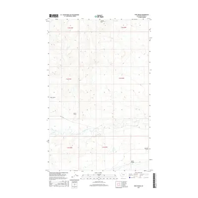
2017 Map of Fort Piegan
USGS Topo · Published 2017About this map
Fort Piegan serves as the focal point for this section of Glacier County, situated within a vast landscape defined by glacial erosional features. The terrain is marked by significant topographical markers like Antelope Butte in the north and the deep incisions of Cobell Coulee and Powell Coulee which drain toward the south. The hydrological network is dominated by the winding course of Cut Bank Creek, which is joined by Willow Cr in the southwestern quadrant. These waterways reflect the characteristic drainage patterns of the Montana plains, where narrow coulees provide the primary relief in an otherwise expansive high-prairie environment. Transport across this sparsely populated region is facilitated by routes like Art Perrine Rd, providing access to the remote township and range sections that organize the local land use and ranching history.
Find a feature on this map
14 named features on this map. Tap any name to fly to it.
Don’t see what you’re looking for? This feature index may not catch every label — zoom into the map to look around manually.
Map Details
Editions of this 2017 Fort Piegan Map
This is the sole edition of this map. No revisions or reprints were ever made.
Other maps of this area

1911 · Blackfoot
USGS Topo · 1:125,000

1960 · Cut Bank
USGS Topo · 1:250,000

1963 · Cut Bank
USGS Topo · 1:250,000

1964 · Cut Bank
USGS Topo · 1:250,000

1968 · Buffalo Lake
USGS Topo · 1:24,000

1968 · Rimrock Butte
USGS Topo · 1:24,000
1968 · Mission Lake East
USGS Topo · 1:24,000

1968 · Rocky Buttes
USGS Topo · 1:24,000
1968 · Kipp Lake
USGS Topo · 1:24,000
1968 · Mission Lake West
USGS Topo · 1:24,000