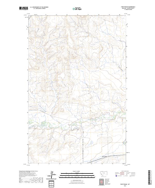
2024 Map of Fort Piegan
USGS Topo · Published 2024About this map
Fort Piegan is situated near the southern edge of this Montana landscape, where the meandering course of Cut Bank Creek flows eastward through the high plains. The terrain is defined by its drainage patterns, with Gillam Coulee and Cobell Coulee cutting through the topography toward the main watercourse. Local access is maintained through routes such as Brandvold Rd and Art Perrine Rd, which navigate the grid of the Public Land Survey System across several townships. The map illustrates a rural area of Glacier County characterized by its hydrology, including the confluence where Willow Creek joins the larger creek system, reflecting the traditional ranching and open-range character of the northern Montana plains in the early twenty-first century.
Find a feature on this map
13 named features on this map. Tap any name to fly to it.
Don’t see what you’re looking for? This feature index may not catch every label — zoom into the map to look around manually.
Map Details
Editions of this 2024 Fort Piegan Map
This is the sole edition of this map. No revisions or reprints were ever made.
Other maps of this area

1911 · Blackfoot
USGS Topo · 1:125,000

1960 · Cut Bank
USGS Topo · 1:250,000

1963 · Cut Bank
USGS Topo · 1:250,000

1964 · Cut Bank
USGS Topo · 1:250,000

1968 · Buffalo Lake
USGS Topo · 1:24,000

1968 · Rimrock Butte
USGS Topo · 1:24,000
1968 · Mission Lake East
USGS Topo · 1:24,000

1968 · Rocky Buttes
USGS Topo · 1:24,000
1968 · Kipp Lake
USGS Topo · 1:24,000
1968 · Mission Lake West
USGS Topo · 1:24,000