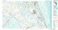
1986 Map of Fort Pierce
USGS Topo · Published 1986About this map
Fort Pierce and the burgeoning Atlantic coast dominate this mid-1980s topographic-bathymetric survey, showing the intensive drainage and transportation networks that reshaped Southeast Florida. The landscape is defined by the rigid geometry of the Belcher Canal and St Lucie Canal, which link the vast waters of Lake Okeechobee to the coast. Along the eastern shoreline, the Indian River separates the mainland from barrier islands like Hutchinson Island and Jupiter Island, protected in part by the Jensen Beach to Jupiter Inlet Aquatic Preserve.
Find a feature on this map
82 named features on this map. Tap any name to fly to it.
Don’t see what you’re looking for? This feature index may not catch every label — zoom into the map to look around manually.
Map Details
Editions of this 1986 Fort Pierce Map
This is the sole edition of this map. No revisions or reprints were ever made.
Other maps of this area

1948 · Palm City
USGS Topo · 1:24,000

1948 · Ankona
USGS Topo · 1:24,000

1948 · Rood
USGS Topo · 1:24,000

1948 · St. Lucie Inlet
USGS Topo · 1:24,000

1948 · Gomez
USGS Topo · 1:24,000

1948 · Hobe Sound
USGS Topo · 1:24,000

1948 · Jupiter
USGS Topo · 1:24,000

1948 · Eden
USGS Topo · 1:24,000

1948 · Indrio
USGS Topo · 1:24,000

1949 · Rood
USGS Topo · 1:24,000