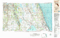
1988 Map of Fort Pierce
USGS Topo · Published 1988About this map
Lake Okeechobee and the expansive Indian River lagoon system dominate this late-1980s topographic and bathymetric study of South Central Florida. The landscape transitions from the coastal urban corridor of Fort Pierce and Vero Beach to the interior agricultural and conservation lands. Notable protected areas such as Pelican Island National Wildlife Refuge and Jonathan Dickinson State Park illustrate the region's environmental management.
Find a feature on this map
112 named features on this map. Tap any name to fly to it.
Don’t see what you’re looking for? This feature index may not catch every label — zoom into the map to look around manually.
Map Details
Editions of this 1988 Fort Pierce Map
This is the sole edition of this map. No revisions or reprints were ever made.
Other maps of this area

1944 · Plant City
USGS Topo · 1:31,680

1944 · Lakeland
USGS Topo · 1:31,680

1944 · Auburndale
USGS Topo · 1:31,680

1948 · Palm City
USGS Topo · 1:24,000

1948 · Ankona
USGS Topo · 1:24,000

1948 · Rood
USGS Topo · 1:24,000

1948 · St. Lucie Inlet
USGS Topo · 1:24,000

1948 · Gomez
USGS Topo · 1:24,000

1948 · Hobe Sound
USGS Topo · 1:24,000

1948 · Jupiter
USGS Topo · 1:24,000