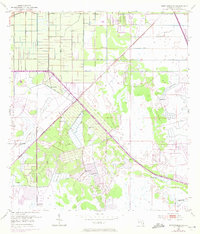
1953 Map of Fort Pierce SW
USGS Topo · Published 1970About this map
Agricultural and drainage infrastructure dominate this portion of St. Lucie County, reflecting the mid-century transformation of the Florida landscape. The introduction of the Floridas Turnpike and the Florida East Coast rail line cut diagonally across a terrain defined by water management. A complex network of engineering features, including the Header Canal, Rim Ditch, and numerous segments of Levee, indicates a concerted effort to reclaim and utilize the low-lying wetlands.
Find a feature on this map
10 named features on this map. Tap any name to fly to it.
Don’t see what you’re looking for? This feature index may not catch every label — zoom into the map to look around manually.
Map Details
Editions of this 1953 Fort Pierce SW Map
4 editions found

Other maps of this area

1948 · Palm City
USGS Topo · 1:24,000

1948 · Ankona
USGS Topo · 1:24,000

1949 · Fort Pierce
USGS Topo · 1:24,000

1949 · Fort Pierce NW
USGS Topo · 1:24,000

1950 · Ankona
USGS Topo · 1:24,000

1950 · Fort Pierce
USGS Topo · 1:24,000

1950 · Palm City
USGS Topo · 1:24,000

1950 · Fort Pierce NW
USGS Topo · 1:24,000

1953 · Okeechobee 1 SE
USGS Topo · 1:24,000

1953 · Okeechobee 4 NE
USGS Topo · 1:24,000