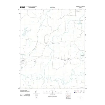
2010 Map of Fort Pillow
USGS Topo · Published 2010About this map
The meandering Hatchie River and its labyrinth of oxbows and tributaries like Mathis Creek define the landscape of this West Tennessee quadrangle. Near the Mississippi River bluffs, the Fort Pillow State Farm occupies a historic site overlooking the bottomlands. The map reveals a high concentration of country burial grounds, including the Lightfoot Cemetery and Pilgrims Rest Cemetery, which anchor the rural community around the settlement of Pleasant Hill. The topography is dominated by the floodplains of Cane Creek and Cold Creek, featuring water management structures such as the Cane Creek Number Twenty-two Dam. In the south, Millstone Mountain rises as a distinct landmark above the junction of several local creeks, while Bee Lake and Sunk Lake reflect the unique geomorphology of this river-adjacent region.
Find a feature on this map
62 named features on this map. Tap any name to fly to it.
Don’t see what you’re looking for? This feature index may not catch every label — zoom into the map to look around manually.
Map Details
Editions of this 2010 Fort Pillow Map
This is the sole edition of this map. No revisions or reprints were ever made.
Other maps of this area

1939 · Hales Point
USGS Topo · 1:62,500

1939 · Blytheville
USGS Topo · 1:62,500

1952 · Hales Point
USGS Topo · 1:62,500

1955 · Blytheville
USGS Topo · 1:62,500

1956 · Blytheville
USGS Topo · 1:250,000

1959 · Blytheville
USGS Topo · 1:250,000

1961 · Hales Point
USGS Topo · 1:62,500

1961 · Rialto
USGS Topo · 1:62,500

1962 · Rialto
USGS Topo · 1:62,500

1962 · Hales Point
USGS Topo · 1:62,500