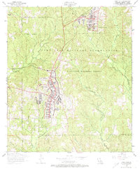
1954 Map of Fort Polk
USGS Topo · Published 1974About this map
The Fort Polk Military Reservation and the surrounding Kisatchie National Forest dominate this mid-century landscape in Vernon Parish. Grounded in a 1954 field check, the map reveals the complex infrastructure of Fort Polk and North Fort Polk, featuring an airfield, a golf course, and a swimming pool set against a network of training grounds. The terrain is defined by a dense hydrological system including Whisky Chitto Creek, Bundick Creek, and Bayou Zourie, which carve through the wooded hills.
Find a feature on this map
35 named features on this map. Tap any name to fly to it.
Don’t see what you’re looking for? This feature index may not catch every label — zoom into the map to look around manually.
Map Details
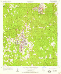
Editions of this 1954 Fort Polk Map
2 editions found
Other maps of this area

1941 · Leesville
USGS Topo · 1:62,500

1941 · Slagle
USGS Topo · 1:62,500

1943 · Leesville
USGS Topo · 1:62,500

1944 · Slagle
USGS Topo · 1:62,500

1946 · Leesville
USGS Topo · 1:62,500

1947 · Rosepine
USGS Topo · 1:31,680

1947 · Chasmore
USGS Topo · 1:31,680

1947 · Sugrue
USGS Topo · 1:31,680

1948 · Leesville
USGS Topo · 1:62,500

1952 · Lake Charles
USGS Topo · 1:250,000
Featured Places
- Fort Polk, Fort Johnson South
- Sandy Hill, LA
- North Fort Polk, LA
- Fort Johnson South, LA
- Vernon Parish, LA